November 4, 2012
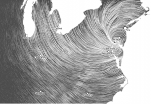
More Hurricane Sandy scale
This wind map (click to embiggen) is from hint.fm, who we’ve linked to before. It shows the national short-term forecast wind grid, just after Sandy crossed the coast. For scale, the distance between Boston (top right) and Charlotte (bottom) is almost exactly the distance between Auckland and Invercargill
Thomas Lumley (@tslumley) is Professor of Biostatistics at the University of Auckland. His research interests include semiparametric models, survey sampling, statistical computing, foundations of statistics, and whatever methodological problems his medical collaborators come up with. He also blogs at Biased and Inefficient See all posts by Thomas Lumley »
